- 中文版:
- EI 100%收录
- 英文版
- SCI 100%收录


中国出版政府奖提名奖
中国百强科技报刊
湖北出版政府奖
中国高校百佳科技期刊
中国最美期刊
中国出版政府奖提名奖
中国百强科技报刊
湖北出版政府奖
中国高校百佳科技期刊
中国最美期刊
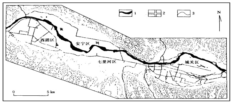
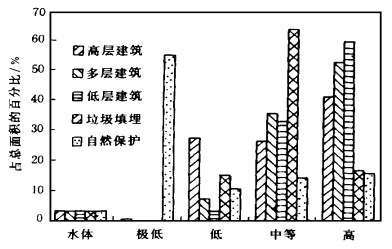
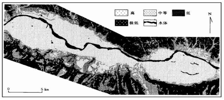
| Citation: | DAI Fuchu, LI Jun, ZHANG Xiaohui, 2000. GIS METHODOLOGY AND ITS APPLICATION TO EVALUATION OF COORDINATION BETWEEN URBAN LAND USE AND GEO-ENVIRONMENTAL POTENTIAL. Earth Science, 25(2): 209-214.

|

| [1] |
Hiscock K M, Lovett A A, Brainard D G, et al. Groundwater vulnerability assessment: two case studies using GIS methodology[J]. Quarterly Journal of Engineering Geology, 1995, 28: 179~194. doi: 10.1144/GSL.QJEGH.1995.028.P2.09
|
| [2] |
Carrara A, Cardinali M, Detti R, et al. GIS techniques and statistical modelsin evaluating landslide hazard[J]. Earth Surface Processes and Landforms, 1991, 16: 427~445. doi: 10.1002/esp.3290160505
|
| [3] |
Mejia-Navarro M, Garcia L A. Natural hazard and risk assessment using decision support systems, application: Glenwood Springs, Colorado[J]. Environmental & Engineering Geoscience, 1996, 2(3): 299~324.
|
| [4] |
王思敬, 戴福初. 环境工程地质评价、预测与对策分析[J]. 地质灾害与环境保护, 1997, 8(1): 27~34. https://www.cnki.com.cn/Article/CJFDTOTAL-DZHB701.002.htm
|
| [5] |
石有维. 城市建设用地适宜性评价——以鞍山市为例[J]. 中国土地科学, 1993, 7(5): 28~32. https://www.cnki.com.cn/Article/CJFDTOTAL-ZTKX199305008.htm
|
| [6] |
Dai F C, Liu Y H, Wang S J. Urban geology: a case study of Tongchuan city, Shaanxi Province, China[J]. Engineering Geology, 1994, 38: 165~175.
|
| [7] |
王莲芬, 许树柏. 层次分析法引论[M]. 北京: 中国人民大学出版社, 1989.
|
Figures(3) / Tables(1)


 DownLoad: